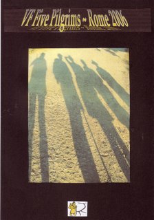
www.vfpilgrims.blogspot.com
2006:
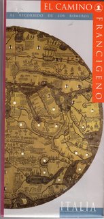
When Joy and I were in Santiago de Compostela in 2004 we visited the museum where I collected a few leaflets and brochures. I happened to pick up a map with the title: El Camino Francigeno. I presumed that it was one of the camino routes through Spain and it wasn't until I got home and opened it that I saw it was a map on the route of the pilgrimage trail to Rome through Italy. Well, of course I started to dream about it! I went onto the
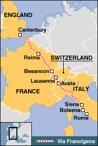
Association International Via Francigena website. The Via Francigena follows the route taken by Archbishop Sigeric in 990AD who wrote about his journey to Rome to collect his stole of office - the palium - when he was appointed archbishop. This document was found in the early 1990's and is now in the British Museum. Of course I started dreaming about walking to Rome and in September mentioned that I was thinking of organising a walk to Rome. A number of friends showed an interest and in the e
nd five of us committed to walking the VF to Rome.
We joined the AIVF and I joined the
VF Yahoo group. As none of us could afford the time (or the money) to walk from Canterbury to Rome, we asked pilgrims who had done the walk to
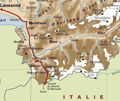
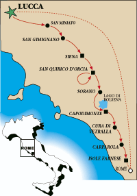
recommend the best sections to walk in 30 days. We were told that the Swiss section was really beautiful; the Valle d'Aosta was stunning; the route across the north of Italy - from around Ivrea to Fidenza or Fornovo was flat, industrial with large espanses of rice paddies and could be missed. So we planned a 30 day pilgrimage starting on Lac Leman - walking to Ivrea - train to Parma. We decided to also skip a short section from Pontremoli to Lucca.

For a full account of our walk to Rome, you can visit:
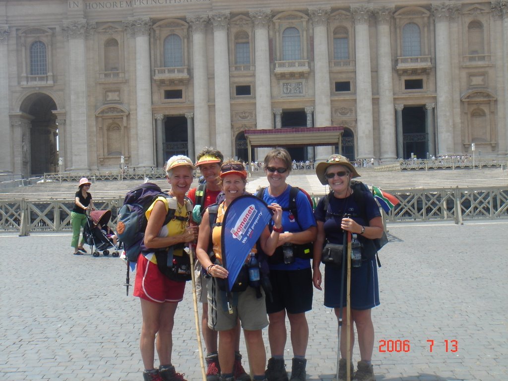
www.vfpilgrims.blogspot.com Suffice to say that we had the most WONDERFUL walk to Rome. The weather was amazing - almost too hot at times. The five of us got on exceptionally well and there never any quarrels or 'fish lips'.

The average age of the VF five was 55 years
We walked 684kms. With an average step length of 75cm that means they took over 912,000 steps on their way to Rome.
We walked for an average of 25km per day - 27 days and one day off.
The average cost of our 28 days accommodations was €21.50 – many included breakfast. (All accommodation was booked in advance).
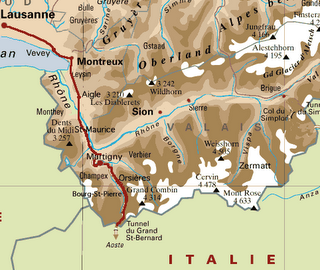
Facts: We crossed two passes, the Grand St Bernard – 2473m and the Cisa Pass -1050m.
We started in Switzerland at Vevey on Lac Leman. In Italy we walked through the Valle D’Aosta, Piemont, Emilia-Romanga, Tuscany and Lazio.
Our longest day was 11 ½ hours and our longest distance was 36.3km.
We passed through over 210 villages and towns and crossed more than 150 rivers.
We crossed a variety of bridges, metal, wood, hanging, stone, Roman etc
The town with the lowest altitude was Lucca at 19m asl and the place with the highest altitude was the Gr St Bernard Pass at 2472m asl.
We climbed from 870m at La Douay to 2473m at the Gr St Bernard Pass in 25kms and 11 ½ hours.
On some days the temperatures reached +40oC.
We only had three days with some rain - walking through one violent thunderstorm.
We caught a train from Ivrea to Parma and a train from Pontremloi to Lucca.
Our backpacks weighed between 8kg and 10kg.
Dinner: We made their own dinner in 8 places: ate ‘in’ at 10 different places (hospice, convent, hotels etc) and went ‘out’ for dinner 10 times.
Bed: We stayed in a backpackers, a hospice, a campsite, a gité, a castle, on a farm, three youth hostels, nine B&B’s, two convents, six hotels (one a converted monastery) and two apartments. Mostly in 2 bed and 3 bed rooms.
Breakfast: 18 places provided breakfast – usually pre-packed long life bread, croissants, biscuits, melba toast and jam with tea or coffee. We bought yoghurt, fruit and cereal to share for breakfast.
We lost a variety of items on the route: water bottles, walking stick, cap, sunglasses, cloths, guidebook, air ticket.
Although we didn’t have an English guide book, at no time did we actually get lost – only confused a couple of times - usually when following the VF signs along the way.
We used a variety of resources to find our way:
Topofrancigena m
aps from
www.francigena-international.org.
Itinerario a Piedi maps from the AVF -
http://www.assoicazionefrancigena.com/ as well as the ‘Itinerary and Leggs’ from the same website. These were all in Italian and after being translated by Google and Babelfish, we were left with what we called their ‘Cryptic Clues’. (eg: “Salt towards the mouth of the dog” and “ask a circle” – meaning “ask around”.)
We are busy compiling a self-print coffee-table book comprising our daily blog posts, comments, resources and photographs. Val is compiling a Food Report chapter. It should be ready in 2007.


 ARILLAS ONCE AGAIN.
  couple of huge, ancient trees along the camino which she will just love to hug! I found a couple of photos of big trees on the Internet just for her! This will be a whole new experience for me. I have only walked in Spring - May, June and July - and I'm looking forward to the different landscapes of the summer and autumn. Also, a HUGE plus this time is that my darling husband, Finn, will join us to walk the last 114kms from Sarria. For the past four years I have been a camino junkie and besides the little library of books,
  videos, DVD, maps, brochures and posters, we have also hosted the annual St James Feast Day celebrations at ou

